eTrex H
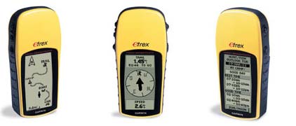
Perfect for outdoor enthusiasts on a budget, eTrex H comes with a high-sensitivity GPS receiver that locks onto satellite signals quickly and maintains accuracy - even in the toughest conditions. And just like the popular eTrex, this little yellow wonder combines an intuitive interface and a rugged exterior into a lightweight handheld that fits in the palm of your hand.
Enjoy Clear Reception
With its high-sensitivity, WAAS-enabled GPS receiver, eTrex H locates your position quickly and precisely and maintains its GPS location even in heavy cover and deep canyons. The advantage is clear - whether you're in deep woods or just near tall buildings and trees, you can count on eTrex H to help you find your way when you need it the most.
Built for Adventure
You can operate your eTrex H with just one hand using five buttons, which are located on either side of eTrex H within easy reach of your fingers. Thanks to its bright yellow case, eTrex H is easy to find in your boat or backpack. And, eTrex H is IPX7 waterproof, so it can take an accidental splash or dunk in the water and still continue to perform.
Find It and Go
With eTrex H, your adventure can last and last - up to 17 hours on just 2 AA batteries. While you roam, you can store up to 500 waypoints in memory for easy retrieval. Just enter the point you want to go to, and eTrex H points you to your destination (no street or terrain maps). To get home, use Garmin's exclusive TrackBack® feature to reverse your track log and help you navigate back to your starting point. eTrex H: Lock onto the great outdoors.
Physical & Performance
| Unit dimensions, WxHxD: | 4.4" x 2.0" x 1.2" (11.2 x 5.1 x 3.0 cm) |
| Display size, WxH: | 1.1" x 2.1" (2.8 x 5.4 cm) |
| Display resolution, WxH: | 64 x 128 pixels |
| Display type: | 4 level gray LCD |
| Weight: | 5.3 oz (150 g) with batteries |
| Battery: | 2 AA batteries (not included) |
| Battery life: | 17 hours |
| Waterproof: | yes (IPX7) |
| Floats: | no |
| High-sensitivity receiver: | yes |
| Interface: | serial |
| RoHS version available: | yes |
Maps & Memory
| Basemap: | no |
| Preloaded street maps: | no |
| Ability to add maps: | no |
| Built-in memory: | no |
| Accepts data cards: | no |
| Waypoints/favorites/locations: | 500 |
| Routes: | 20 |
| Track log: | 10,000 points, 10 saved tracks |
Features
| Automatic routing (turn by turn routing on roads): | no |
| Electronic compass: | no |
| Touchscreen: | no |
| Barometric altimeter: | no |
| Geocaching-friendly: | no |
| Outdoor GPS games: | no |
| Hunt/fish calendar: | yes |
| Sun and moon information: | yes |
| Tide tables: | 10,000 points, 10 saved tracks |
| Area calculation: | no |
| Custom POIs (ability to add additional points of interest): | no |
| Unit-to-unit transfer (shares data wirelessly with similar units): | no |
| Picture viewer: | no |
Copyright © 1996-2010 varun. or its subsidiaries